


xxSOLDxx French & Indian War map horn Ft. Wm Henry
F & I War Map Horn-Ft. Wm Henry
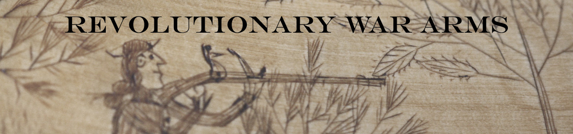
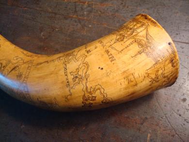
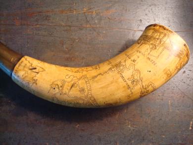
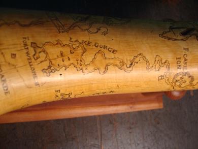
Large French and Indian War period map horn in excellent original condition, measuring 15 1/2" across the curve. The butt measures 3 1/2" at its widest. Wonderful mellow golden brown patenae, still retaining traces of original polychrome highlights. Scrimshawed city scapes of New York City and Albany as well as all of the important forts and stations on the disputed north-south and east-west trade waterways. The scrimshaw includes a large and folky royal coat of arms as well as several tall ships. Although this map horn does not include a date or name, careful study of it reveals that it was created early in the F & I conflict, before 1757 probably by a colonist of Dutch extraction. The fact that Ft. William Henry and Ft. Carilion appear on this horn date it pre 1757 because Ft. Carilion was the French name for Ft. Ticonderoga, indicating that the French still occupied it, and Ft. William Henry was destroyed in 1757 (i.e. Last of the Mohicans). Also Ft. William Henry is labeled "Fort Wellome H.", Fort Johnson (ie Sir Wm Johnson's stone manor house) is labeled "Janson Ft.", and Ft. Henry is labeled "Ft. Hante", all Dutch versions of the equivalent English names. A great F & I War map horn in unmolested excellent condition. **SOLD**